| MIN Elevation |
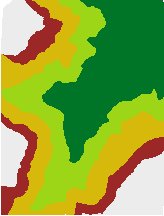 |
| Slope |
 |
| Aspect |
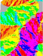 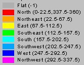 |
| Hillshade |
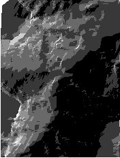 |
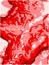
| MIN Elevation illuminated with Hillshade values |
 |
NOTES:
- See TIN notes for more information about Triangulated Irregular Network (TIN)
- The free Profile Extractor 6.0 for ArcView can be used to extract profile for virtually any shape from an ET TIN
The procedure involves
- Collects the points from a point theme (vertices) if the source is a polyline theme
- Cleans duplicate points
- Creates the TIN structure
- If the 3D polygon option is selected – the elevations from the source theme are transferred to the vertices of the 3D polygons ( triangles)
Notes:
- To achieve best results when creating TIN from Polyline theme use Generalize or Densify in order to remove unnecessary points or add points to the long straight segments
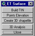
Points Elevation - extracts the elevation of the points in a point theme from 3D Polygon theme - TIN created with the Build TIN procedure. Free (no restrictions in the DEMO version)
Create 3D Shapefile - extracts the elevations of the vertices of the features of a Polyline or Polygon theme and creates respectively PolylineZ or PolygonZ shapefile.Free (no restrictions in the DEMO version)
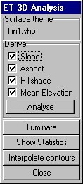
3D Analysis:
- Analyze - derives MIN and MAX Elevation, Slope, Aspect, Hillshade and
Mean Elevation for all the triangles in the selected TIN theme. Calculates statistics for
the TIN. Check the appropriate Check Box to get the desired results. The results are
stored in the polygon attribute table and can be used for classifying the TIN theme
- Slope - identifies the slope, or maximum rate of elevation change for each triangle
- Aspect - the values of the output field represent the compass direction of the aspect; 0 is true north, a 90 degree aspect is to the east etc. For flat triangles (slope = 0) the value of -1 is assigned for the aspect
- Hillshade - computes the brightness of each triangle based on a light source location.
The user is requested to input:
- azimuth - the azimuth angle of the light source. The azimuth is expressed in positive degrees from 0 to 360, measured clockwise from the north. The default is 315 degrees.
- altitude - the altitude angle of the light source above the horizon. The altitude is expressed in positive degrees, with 0 degrees at the horizon and 90 degrees directly overhead. The default is 45 degrees.
- Illuminate - applies brightness values to the TIN theme. For best
results in displaying the TIN:
- Apply Graduated Color legend using MIN or MAX Elevation fields
- Illuminate faces using the Hillshade field as brightness theme
- Show statistics - displays a dialog with surface statistics:
- Min Elevation
- Max Elevation
- Mean Elevation
- Min Slope
- Max Slope
- Interpolate contours - converts the TIN to a theme containing contours
or isolines. The user is requested to input:
- Base value - the contour from which to begin generation of contours.
- Contour interval - Z value difference between adjacent contours in map units.