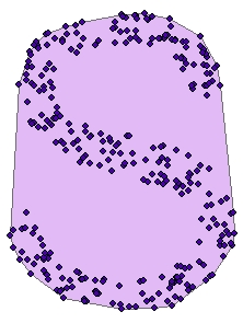
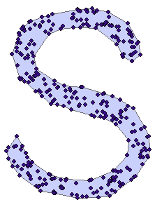
The Concave Hull function creates a polygon that represents the area occupied by a set of data points.
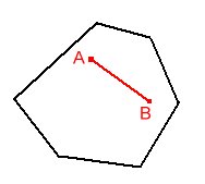
Convex
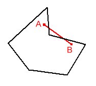
Non Convex (Concave)
Convex Hull
Concave Hull
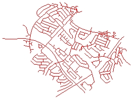
Source Data
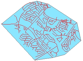
Convex Hull
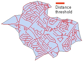
Concave Hull 1
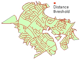
Concave Hull 2
Parameters
| Expression | Explanation |
|---|---|
| Function Name | CreateConcaveHull |
| <input dataset> | A String representing the input layer. Must be of Polygon type. |
| <output dataset> | A String - the full name of the output layer. |
| <Distance Treshold> | A Double representing the threshold for creating a concave hull - in the units of the spatial reference of the input dataset. |
ETGWPath used in the table below is the full path to ETGWRun.exe (E.G. "C:\Program Files\ETSpatial Techniques\ETGeo Wizards\ETGWRun.exe")
| Language | Syntax |
|---|---|
| Python | subprocess.call([ETGWPath, "CreateConcaveHull", "input dataset", "output dataset", "Distance Treshold"]) |
| .NET using ETGWRun.exe | StartInfo.FileName = ETGWPath StartInfo.Arguments = "CreateConcaveHull" "input dataset" "output dataset" "Distance Treshold" |
| .NET using ETGWOutX.dll | CreateConcaveHull(input dataset, output dataset, Distance Treshold) |
| ArcPy | arcpy.CreateConcaveHull(input dataset, output dataset, "Distance Treshold") |
Notes:
<> - required parameter
{} - optional parameter
The argument separator for StartInfo.Arguments is space. If a string might contain a space, you need to double quote it.