Converts a polygon dataset to a point dataset
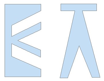
Input Dataset
Result Vertices option
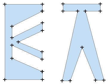
Result Labels option
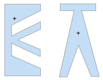
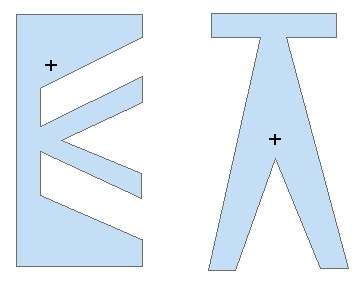
Result Center option
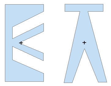
Result Center in option
Parameters
| Expression | Explanation |
|---|---|
| Function Name | PolygonsToPoints |
| <input dataset> | A String representing the input layer. Must be of Polygon type. |
| <output dataset> | A String - the full name of the output layer. |
| <Option> | A String - the convertion option. Valid values.
|
| {Remove Duplicates} | A Boolean indicating whether the duplicate points are to be removed from the output. Used only for "Vertex" option. |
| {Calculate Position} | A Boolean indicating whether the position of the points along the polygon boundary to be calculated. Used only for "Vertex" option. |
| {Keep Z} | A Boolean indicating whether if the input has Z values to keep them in the output. |
| {Keep M} | A Boolean indicating whether if the input has M values to keep them in the output. |
ETGWPath used in the table below is the full path to ETGWRun.exe (E.G. "C:\Program Files\ETSpatial Techniques\ETGeo Wizards\ETGWRun.exe")
| Language | Syntax |
|---|---|
| Python | subprocess.call([ETGWPath, "PolygonsToPoints", "input dataset", "output dataset", "Option", "Remove Duplicates", "Calculate Position", "Keep Z", "Keep M"]) |
| .NET using ETGWRun.exe | StartInfo.FileName = ETGWPath StartInfo.Arguments = "PolygonsToPoints" "input dataset" "output dataset" "Option" "Remove Duplicates" "Calculate Position" "Keep Z" "Keep M" |
| .NET using ETGWOutX.dll | PolygonsToPoints(input dataset, output dataset, Option, Remove Duplicates, Calculate Position, Keep Z, Keep M) |
| ArcPy | arcpy.PolygonsToPoints(input dataset, output dataset,"Option", "Remove Duplicates", "Calculate Position", "Keep Z", "Keep M") |
Notes:
<> - required parameter
{} - optional parameter
The argument separator for StartInfo.Arguments is space. If a string might contain a space, you need to double quote it.