Builds the Convex Hull of the features of a layer
Convex hull is a polygonal area that is of smallest length and so that any pair of points within the area have the line segment between them contained entirely inside the area.
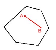
Convex
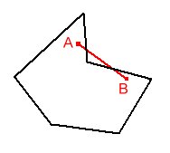
Non Convex (Concave)
Defining the convex Hull of a set of points is useful, for example in the case of enclosing the points, using a fence of shortest total length.
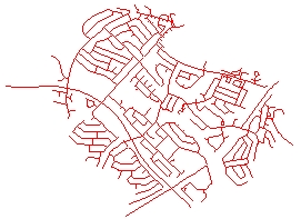
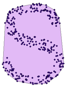
Source Data
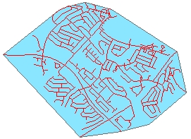
Convex Hull
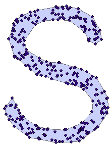
While in general the Convex Hull is good to describe the shape of the input data points, in many cases a polygon that describes better the region occupied by the point cloud is needed. See the Create Concave Hull function
Convex Hull
Concave Hull
Parameters
| Expression | Explanation |
|---|---|
| Function Name | ConvexHull |
| <input dataset> | A String representing the input layer. |
| <output dataset> | A String - the full name of the output layer. |
ETGWPath used in the table below is the full path to ETGWRun.exe (E.G. "C:\Program Files\ETSpatial Techniques\ETGeo Wizards\ETGWRun.exe")
| Language | Syntax |
|---|---|
| Python | subprocess.call([ETGWPath, "ConvexHull", "input dataset", "output dataset"]) |
| .NET using ETGWRun.exe | StartInfo.FileName = ETGWPath StartInfo.Arguments = "ConvexHull" "input dataset" "output dataset" |
| .NET using ETGWOutX.dll | ConvexHull(input dataset, output dataset) |
| ArcPy | arcpy.ConvexHull(input dataset, output dataset) |
Notes:
<> - required parameter
{} - optional parameter
The argument separator for StartInfo.Arguments is space. If a string might contain a space, you need to double quote it.