Creates a topologically correct (nodes at intersections, no overlaps) Polyline dataset
For each polyline the left and right polygon attributes are added.
Optionally the labels of the polygons are exported as points. The point attribute table contains all original
attributes.
Inputs:
A polygon feature layer
Link Field - the values of this field will be
saved as Left and Right polygons for each polyline
Fuzzy tolerance - will be used to clean the
polygon boundaries
Outputs:
New topologically correct Polyline layer.
Fields added to the polyline attribute table
[ET_Left] - stores the Left polygon link values
[ET_Right] - stores the Right polygon link values
Optional Point layer representing the
labels of the input polygons. The attributes of the input polygons are
preserved in the Point Attribute Table
Optional Polygon layer - the input layer clean from overlaps.
Notes :
The default Fuzzy tolerance is calculated from the extents of the input layer using the
formulae (W + H) / 2000000 where W and H are the with and height of the extent envelope.
Larger values of the Fuzzy tolerance may be used to clean some bigger Gaps and Slivers, but it might lead to unwanted approximation of the input shapes.
A Fuzzy tolerance = 0 will be replaced by the default value
If a polyline does not have Left polygon, the
value of the ET_Left field will be set to empty string. In topologically
correct polygon dataset this should indicate the outer boundary (neighboring
with the so-called Universal Polygon. Empty values in the interior
of the polygon dataset will indicate gaps or overlaps in the data.
If the input polygon layer has overlaps it is strongly recommended to use the Clean Polygons function beforhand
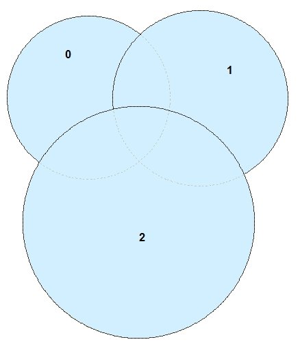
Input Polygons with overlaps
Result if the function is performed on the overlapping polygons
Result if the overlaps are cleaned beforehand
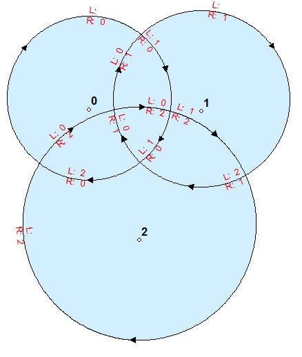
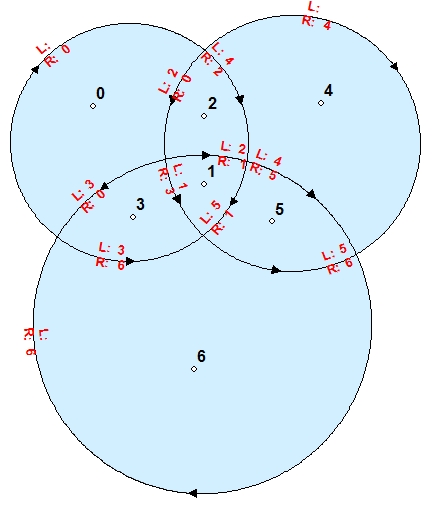
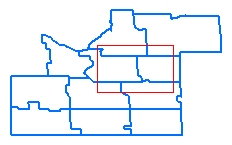
Example:
Original polygons
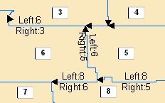
Derived polylines.
Nodes in intersections
No duplicates
The polylines on the boundary of the area will have empty ET_Left
Polylines labeled with their Left and Right polygons. Polygons labeled with the Link field used in the function.