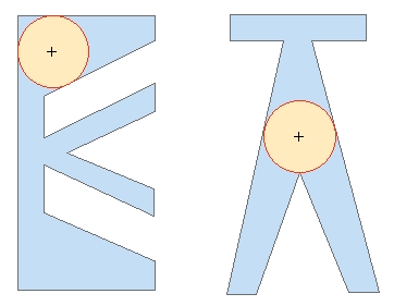
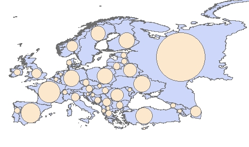
Creates from each polygon in the input feature class a circular polygon representing the circle with maximum radius that can be inscribed in the input polygon. The center of the is located in the "deepest" point of each polygon. Attributes of the original features are transferred to the resulting polygons.
The function uses an interpolation algorithm and the precision of the calculation might not be 100%
Example 1
Example 2 - Europe
Parameters
| Expression | Explanation |
|---|---|
| Function Name | PolygonsToMaxInscribedCircles |
| <input dataset> | A String representing the input layer. Must be of polygon type. |
| <output dataset> | A String - the full name of the output layer. |
ETGWPath used in the table below is the full path to ETGWRun.exe (E.G. "C:\Program Files\ETSpatial Techniques\ETGeo Wizards\ETGWRun.exe")
| Language | Syntax |
|---|---|
| Python | subprocess.call([ETGWPath, "PolygonsToMaxInscribedCircles", "input dataset", "output dataset"]) |
| .NET using ETGWRun.exe | StartInfo.FileName = ETGWPath StartInfo.Arguments = "PolygonsToMaxInscribedCircles" "input dataset" "output dataset" |
| .NET using ETGWOutX.dll | PolygonsToMaxInscribedCircles(input dataset, output dataset) |
| ArcPy | arcpy.PolygonsToMaxInscribedCircles(input dataset, output dataset) |
Notes:
<> - required parameter
{} - optional parameter
The argument separator for StartInfo.Arguments is space. If a string might contain a space, you need to double quote it.